This stop was suggested by Jan and Ron Schmidt, friends from Confer, CO. And it was a great place to visit. To get there from Las Cruces we had to drive over Apache Pass, a famous mountain pass used by the Apache Indians and then by early settlers. The Apaches raided the settlements, which resulted in the siting of Fort Bowie (which can be visited down a 3-mile hiking trail - which we chose not to explore.. However, this pass over the Chiricahua Range was bypassed by the railroad and later by Interstate 10. The current road that goes by the ruins of the fort (there is a 1-mile trail to Fort Bowie, which is a National Monument) and over the pass is unpaved (i.e., dirt). But the road is not very long and Chiricahua NM is a short way south on the western side of the range.
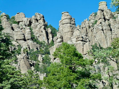
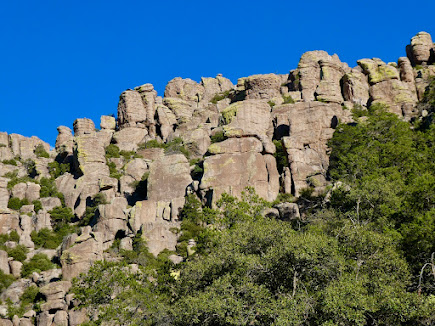
Chiricahua NM is a "sky island," an isolated mountain range rising above the surrounding grassland area. The landscape is typical of the basin and range topography in this part of the Southwest. Its rock pinnacles loom over a road that weaves around several canyons up to the crest. The rocks originated from volcanic ash spewed by the Turkey Creek Volcano 26 million years ago, which melted together to form gray rhyolite.
Over eons of weathering, cracks developed, water enlarged the cracks and washed away the weaker materials leaving behind a variety of spires, balanced rocks and other shapes. Some of the shapes resemble objects or animals and have been given nicknames. We walked about a mile out and back along a trail that led to a collection of rocks called the Grottoes, enjoying the warm sunshine and the improbable rock formations, some of which looked they could tip over in a strong wind. The park has a wide variety of bird and mammal life, although we only saw white-tailed deer.


We left Chiricahua and drove to Willcox, AZ, a small town and checked in to the Arizona Sunset Inn and Suites. Just after arriving, we met up with Jan and Ron, who are joining the Road Runner Tour for its last few days. They and friends have been hiking and climbing in the neighborhood, including Guadalupe Peak NP and near Ruidoso, NM, north of Alamogordo and next to the Apache Reservation. They did make the trek into Fort Bowie and reported that it was very interesting. After cleaning up, we all went for dinner at a local BBQ place.


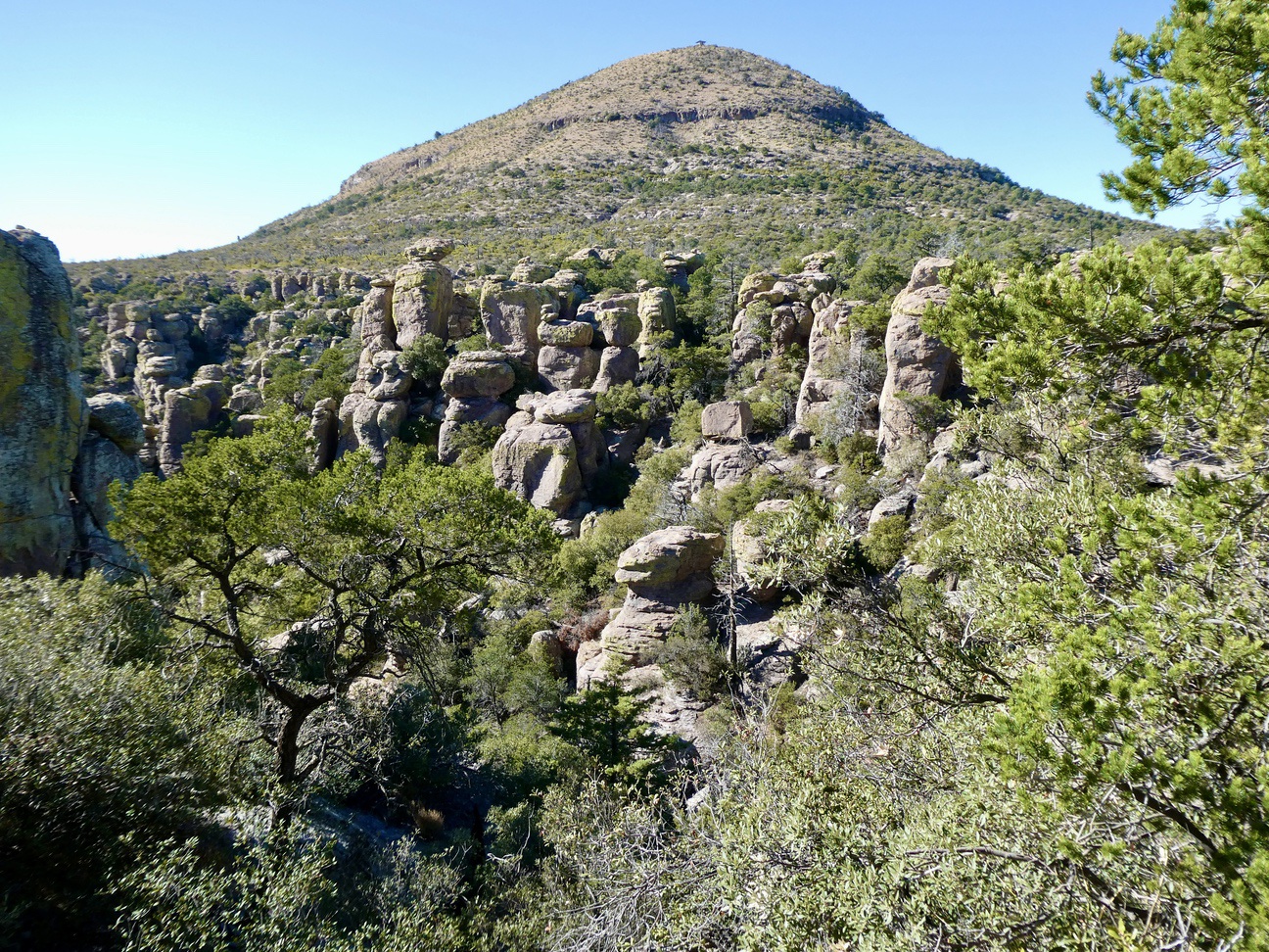
Sugarloaf Mountain.


I named this on the "Mushroom Cloud."


Some sort of rock animal in the distance.

A "turtle."

An old man with a large nose.

The Grottoes.


A hiking boot kicking the behind of a sheep.

A spiny lizard (maybe 4 inches long) climbing up a crack.

The weathering process explained.


The "Organ Pipe" formation.
Today, we took off for Tucson, AZ, about an hour west of Willcox, but first drove south to Bisbee, AZ, home of a large copper pit mine and now a mountain town with twisty streets, quaint shops and many antique stores. We then drove through Tombstone (site of the OK Corral), but it was a tourist trap and we didn't stop. We drove most of the way to Tucson, but diverted to Saguaro National Park East. We saw the visitor center, watch a 20-minute movie on the park and then drove around an 8-mile scenic drive with several stops.

One of two inactive pits in Bisbee - 900 feet deep.


A hillside above the mine, coated with slag

A very unique manhole cover.

Still on the road runner tour.

Overlooking Bisbee.

A front yard of someone's house. Many homeowners use rusty car doors for gates.

The Main Street.

On to Saguaro NP East to view the icon of the western deserts.


Stag Horn cholla.

Teddy Bear cholla -the spines only look soft . . .

Fish Hook Barrel cacti - the spines are shaped like tiny fish hooks.

Saguaro cactus spines.

A very rare variant of the Saguaro cactus called a "Cristate Saguaro." It has a bulbous head at its peak, possibly the result of bird damage.
We have checked into a very large, posh 4 bedroom, 3 1/2 bath home in Sabino Canyon,Tucson, for the last 3 nights of the trip, and are waiting for Jan and Ron to join us after a day at Chiricahua, conquering peaks.
Glad you are doing this. We are taking notes for our trip in march
ReplyDeleteYour saguaro photos are great!
ReplyDeleteVery cool locations... I will have to take note for a trip to those areas one day!
ReplyDelete