This was the second day on the Abel Tasman Trail and the longest in distance and verts (10.5 miles and 1,600 feet, respectively). The day started off with a boat launch, which is detailed in the photos. We boarded the boat in a parking lot, were pulled by a tractor out onto the sand (it being low tide), and then the boat floated off the trailer. And on we went.
But, first a couple of birds seen as we walked from our B&B to the meeting spot:

A stilt ?

A Heron ?
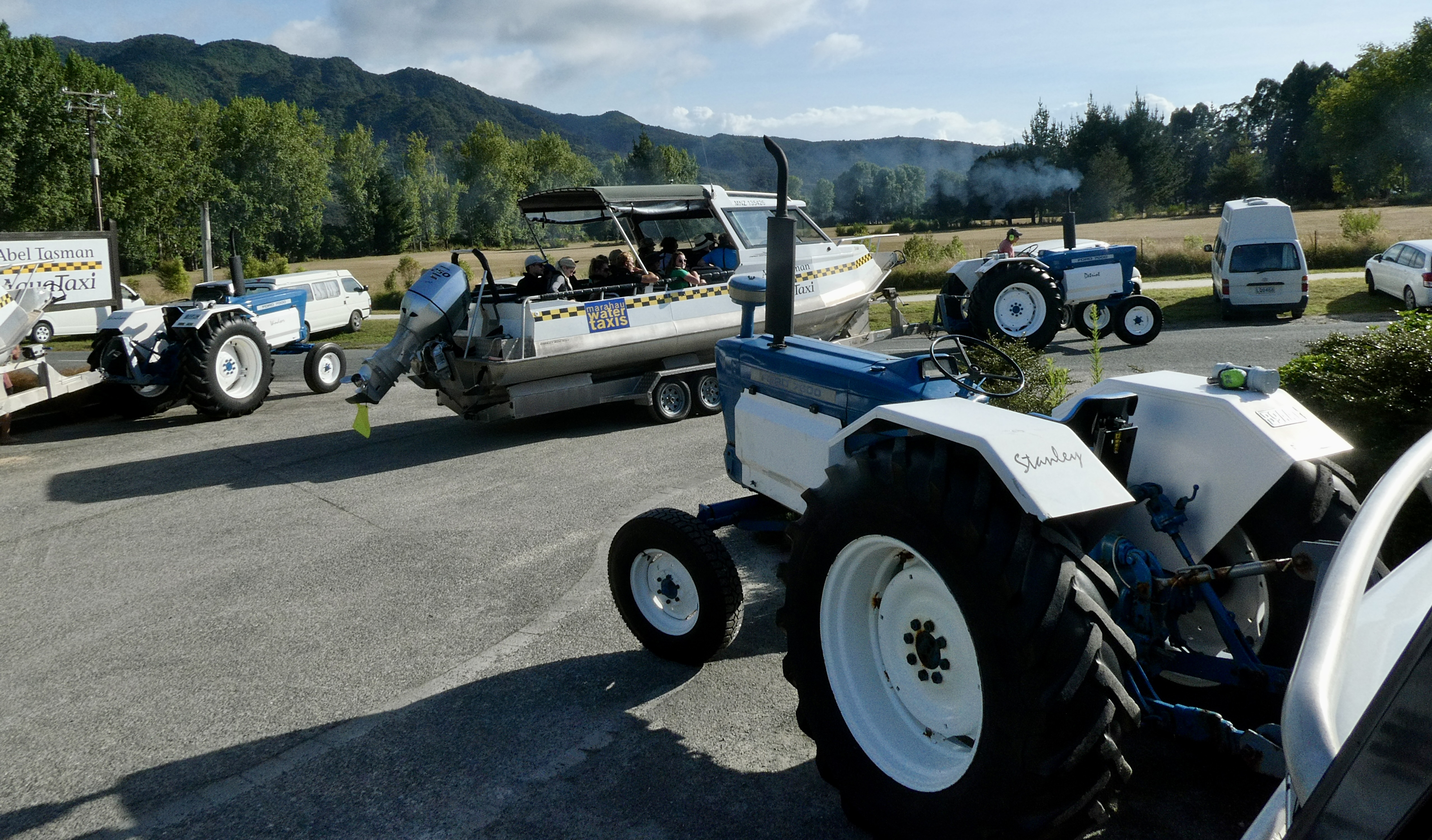
The tractors all leaving at 9:00 am - referred to by the drivers as the 9 am rush hour.


And away we go....

The boats were all going to different destinations but via a couple of tourist sights. The first one is "Split Apple Rock." This is very nice block of "separation granite" that was weathered into a ball, then fractured vertically and had enough support on either side to keep the two halves upright.

More granite fractures. The boats also went off to Adelaide Island, a restricted island for nature that is home to fur seals (which we saw a couple, but no photos) and ground dwelling birds. We then rode and disembarked at Torrent Bay to start walking the second section of the trail.

From the boat, we saw a number of golden sand beaches. This granite has iron in it, which oxidizes (i.e., rusts) and tints the beach sands.

Our walk today was in and out along coastal cliffs, interspersed with stream cuts. We initially walked up from the beach where the boat dropped us, traversed at anywhere from a few hundred feet elevation up to near 450 feet, and then dropped down to seal level at bays with beaches. This photo shows one that is popular and has a number of "bachs" or holiday homes. The backs were built before the national park was established and thus are still privately owned.

The trail is quite well surfaced and almost manicured on the high side (the rock side is cut nearly vertically). Once away from the bays and beaches, the trail is nearly all shaded with native trees and lots of tree ferns, with only occasional views of the ocean.

Another interesting shaped bay/inlet

This is one of two swinging bridges we crossed over today. This is a relatively new bridge and increased its capacity from 5 people to 10.

This is the view from the middle of the swinging bridge.

A closeup of separation granite, an older granite that is crumbly and not nearly as hard as one normally thinks granite is.

Where Betsy and I had our first lunch - Midland Bay. Our second lunch was at Tonga Quarry, which was an historic source of rock that was used to build the Parliament buildings in Wellington and the cathedral steps in Nelson.

A low tide crossing (which is an alternate path) but not when this photo was taken).

Another view from the trail looking down to a beach.

And, a last view before going up and over the last ridge line and arriving at Awaroa Lodge and Cafe. It is a pleasant, ~25 room hotel in the bay of the same name and with most of the modern conveniences. After checking in, Betsy and I went for a dip in the ocean - a bit cool but refreshing. The waves were about 1 to 2 feet high, and stirred feelings in me that I need to go ocean wave jumping again (5 to 8 foot waves). I just don't know where such waves exist. The beach was flat and we walked out several hundred feet to get into 5-foot deep water.
Our entire group (VJRLDBP) gathered for drinks and then dinner at the Lodge's restaurant, most of us had king fish and enjoyed a local Pinot Gris. Betsy and I strolled a bit after dinner, scoping out the first part of the track for tomorrow, which will involve two low tide, water crossings.
Looks like a great adventure!
ReplyDeleteSo glad the trek is going good; pictures are great. Continue well. ET
ReplyDeleteBeautiful places!
ReplyDelete