Sunday, November 5, 2023

Road Runner Tour, Day 12 & 13

We left Terlingua Ranch a day early to move to Alpine, the largest city near Big Bend NP.  (We had seen most of the Big Bend sights and were tired of the long drive to and from the ranch,)  We drove several hours north, arriving around one o'clock.  Alpine is the home of Sul Ross State University, which overlooks the central district.  They also have a several walking routes, one that passes by the historic buildings (constructed circa 1880s to early 1900's), a second route that goes by 44 murals of various sizes painted on the city's buildings.  We picked up the guides for both and walked around.  Attached below are photos of many of the murals.


Name the Country Music Stars


Even the dumpsters are painted


After checking in to our hotel for the night, Betsy and I went out to explore the Sul Ross State University campus and neighborhood.

The main Administration Building - a very impressive red brick with large porticos.  There are similar sized buildings for Science, Fine Arts, and Student Union.

After leaving the campus, we walked around a golf course, seeing this fellow.

And crossing a "Texas bridge."  Note the Flood Gauge in the middle of the span.


Today, we left Alpine for the drive to Guadelupe National Park, stopping at the Pine Springs Visitor Center for an orientation.  Then we moved to Frijole Ranch History Museum for a snack and a short stroll to Manzanita Spring.  We also toured through an early ranch house.

View to El Capitan (far left), Guadalupe Peak (mid left), and the mountain range.  The mountains are part of marine fossil reef that formed 260-270 million years ago.  It is part of a 400-mile long horseshoe shaped Capitan Reef.

More of the Range to the north of previous photo.

Frijole Ranch Historic Museum, sited at an early ranch house, built by the Rader Brothers (the range behind the house is named Rader Range).

Rader Range and view of a canyon that probably is a source of water for one of the several springs that comes out in the foothills.


Friday, November 3, 2023

Big Bend Parks, Days 9, 10 & 11

The Road Runner tour continues, with lots of scenery photos and even a few road runner sightings.

Here are 3 days of very select photos -- I have lots more but will not bore you.  Day 9 was spent in the national park driving the scenic road out to Santa Elena Canyon and then high up into the Chisos Basin.  Day 10 was spent in the state park (which is a bit upriver on the Rio Grande).  And, Day 11, we split up -- Betsy and I hiked nearly 10 miles and 2,000 verts above the lodge in the Chisos Basin, and Elaine, Barbara and Paul toured the last, eastside, visitor center and did some short walks.  We met up at the Lodge for dinner (where they spotted a bear as they were leaving).

The western or Maverick entrance.  Our VRBO was about 50 miles from this point, so we did a lot of driving each day.

Looking up to the Chisos Mountains.

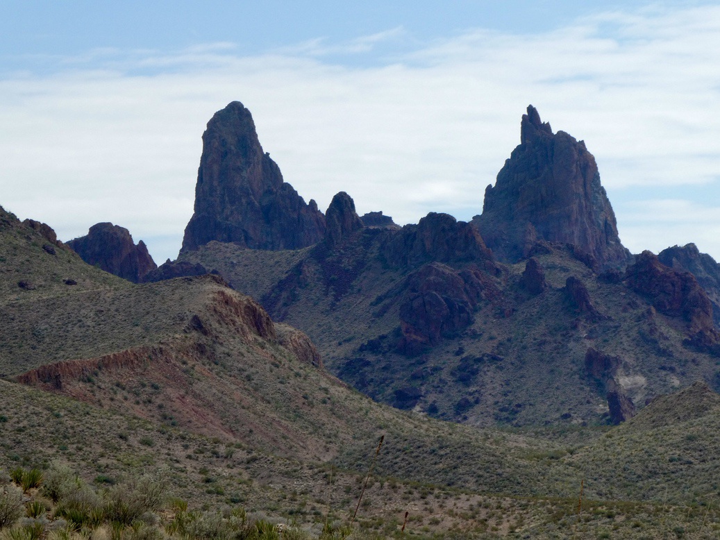
Mules Ears formation.

A distance view of the exit of Santa Elena Canyon.

A closer view of Santa Elena Canyon.  We hiked up over the shoulder on the right side and a short way up the canyon.

The Rock Slide Rapid within the canyon. (Archive photo)

Our first real Road Runner, which turned out to be rather common, but very appealing.

In the Canyon. The walls are 1500 feet high, Mexico is to the left.

Ditto

Emory Peak from the Chisos Basin, mid-park.

More from Chisos Basin

Rio Grande in the Big Bend Ranch State Park (no wall . . .)  The state park is the largest in the US but the only access road runs along the river, so humans see very little of the park.

Another slot canyon called Closed Canyon; on a inflowing creek to the Rio Grande.

Ditto, we walked halfway up until arriving at a 10-foot, slick-rock drop, which we did not want to risk down climbing, since we didn't see a way back up without ropes.

Hoodoos in state park overlooking the Rio Grande.

Ditto

Our VRBO -- Desert Aura, which was located 16 miles off the main highway in Terlingua Ranch, 30 miles northwest of the National Park.  The ranch is large area of desert that is carved up into huge lots of rather bleak homes, trailers, decaying adobes, and miles of rocky, sandy, shrubby desert.  (Most of the roads in this area pass through intermittent dips marked by Flood Height posts - apparently, it is possible to have a lot of rain.)  At the end of the road is a resort which was originally a ranch owned by Carroll Shelby, the famed Ford Mustang engine designer.

Trail sign for our hike - up the Laguna Meadows Trail, cut over on the Colima Trail, then down the Pinnacles Trail back to the trailhead.  We climbed (and descended) about 2,000 feet on well-designed trails with enough switch backs to make the climb tolerable.  The Chisos Basin, in mid-park, is higher and gets more moisture than the surrounding areas, so has trees, grassy meadows, and more wildlife.   it was slightly weird to see people hiking into the area to camp in early November.  We saw a deer or two, and a number of birds that were new to us.  

Acorn Woodpecker

Canyon Towhee

Mexican Jay

Looking back up from whence we came on the Pinnacles Trail (mainly volcanic rocks)

A pinnacle?

Ditto, view to the east

We were scheduled for another day at Big Bend, but we were tired of the driving and the house had a few maintenance issues.  So, we decided to depart a day early and drove north to the nearest "big city" -- Alpine, TX.  I am writing this in a "normal" hotel after walking to dinner.  Alpine is the home of Sul Ross State University; have you ever heard of it?  The actor who played Hoss Cartwright on the TV show Bonanza is an alumnus.

We walked around town viewing the historic buildings, and the many murals painted on them; there are 44 murals.  This will be in my next report along with some of the photos.